

NWS Winter Weather Briefing
Check the upper right-hand corner of each graphic for the latest Issued Date/Time.
This snow depth map is a satellite estimate of snow depth over the area. It may not reflect current actual conditions until skies are clear enough for a good satellite image.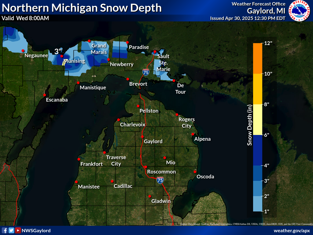
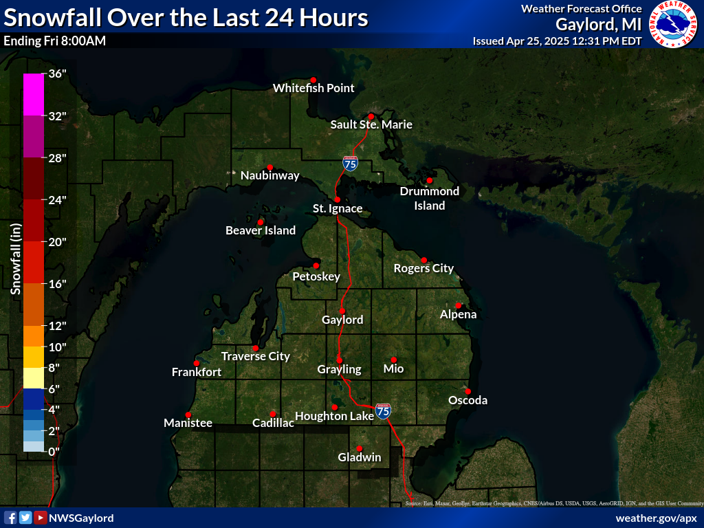
Source:National Weather Service Gaylord.
Source:National Weather Service Gaylord.