NOAA Storm Prediction Center
Convective Outlooks
Convective Outlooks
The convective outlooks serve as guidance to the local NWS forecast offices and are used by emergency managers, private sector meteorologists, media, and other weather customers concerned with public safety. Three separate risk areas (slight, moderate, and high) are used to describe the expected coverage and intensity for the categorical severe weather threat on days 1-3 along with severe weather probabilities for the potential threat.
|
|

Categorical Day2 0700Z Outlook
|
|
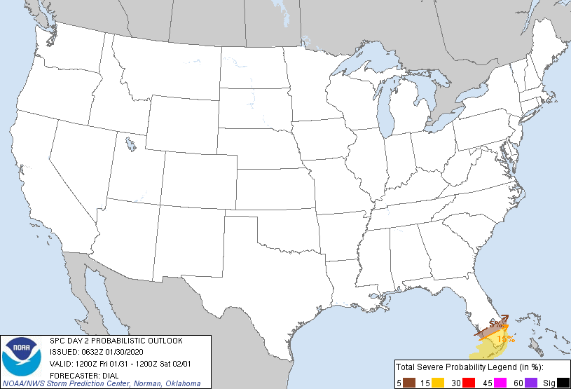
Probability of severe weather within 25 miles of a point.
Hatched Area: 10% or greater probability of significant severe weather within 25 miles of a point.
|
|
|
Images courtesy of the NWS Storm Prediction Center
000
ACUS02 KWNS 190743
SWODY2
SPC AC 190741

Day 2 Convective Outlook CORR 1
NWS Storm Prediction Center Norman OK
0241 AM CDT Fri Apr 19 2024

Valid 201200Z - 211200Z

...THERE IS A MARGINAL RISK OF SEVERE THUNDERSTORMS ACROSS PARTS OF
SOUTH-CENTRAL AND SOUTHEAST TEXAS...

CORRECTED FOR REVERSED THUNDER LINES

...SUMMARY...
Marginally severe storms capable of strong wind gusts and hail will
be possible on Saturday across parts of south-central and southeast
Texas.

...South-central and Southeast Texas...
A shortwave trough will move toward the southern Plains on Saturday,
as zonal flow remains in place across much of the Gulf Coast region.
At the surface, a quasi-stationary front is forecast to be located
across south-central and southeast Texas. South of this boundary, a
moist airmass will be in place with surface dewpoints in the 60s F.
Surface heating will result in destabilization across this airmass
during the day. As instability peaks during the afternoon, and as
low-level convergence increases along and near the front, scattered
thunderstorm development is expected. ECMWF forecast soundings in
south-central Texas during the late afternoon suggest that MLCAPE
will peak near 1200 J/kg, and that 0-6 km shear will be around 40
knots. This would be favorable for an isolated severe threat. The
stronger storms could be associated with isolated damaging wind
gusts and hail. However, limited large-scale ascent and poor lapse
rates will likely keep any severe threat marginal.

..Broyles.. 04/19/2024

$$